Tuesday 1 December 2015

Polar bears and oil spill scares...

To anybody who reads my little cake blog... it has been over 2 years since I wrote last, but I have not stopped baking! It turns out though that the longer you teach, the harder it is to find time for cake-plenaries, let alone writing about them. So here goes, I know this is not quite the "timeline" idea of a blog, but I wanted to catch you up in the hope that it might encourage me to return to this blogging malarkey! (I also suddenly have a new found respect for the world's serious bloggers and vloggers who must literally give over all their time to keeping their social media up to date!)

So, I will start with the annual trip to Slapton Field Studies Centre. Coming here for AS Level fieldwork I have normally tried to keep a vaguely local or relevant theme. So, my first rather tired year saw a Smartie-d attempt at recreating the Ley here at Slapton sands. The hungry (and even more tired than me) sixth formers luckily thought that the change in cake type (as you move backwards from the sea) made up for the lack in decorated glory. Thank goodness for small mercies - and the ability of teenagers to overlook almost anything in order to get free food.


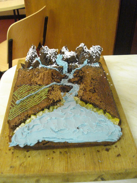
I tried to return to the modelling status quo the following year and link the cake to the fieldwork being undertaken. Cue my attempt at river management slightly impeded by the size of the box available for transportation to Devon! You may be able to pick out the bridge, drainage systems, change in river size and material being carried and deposited downstream of the bridge as well as the settlement on the floodplain. We used this to question the students on the river data they had collected and what they had learnt about management of river systems in the context of flooding and extreme weather.

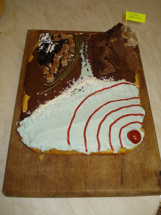
Year 13 have always been a tricky year group to bake for - with topics such as Superpowers and Arctic Conflicts! However I did try...


The obvious issues of representing the oil industry with an inflamed oil rig and an ocean spill were overcome with a lively debate and cost-benefit analysis of oil as the world's major resource


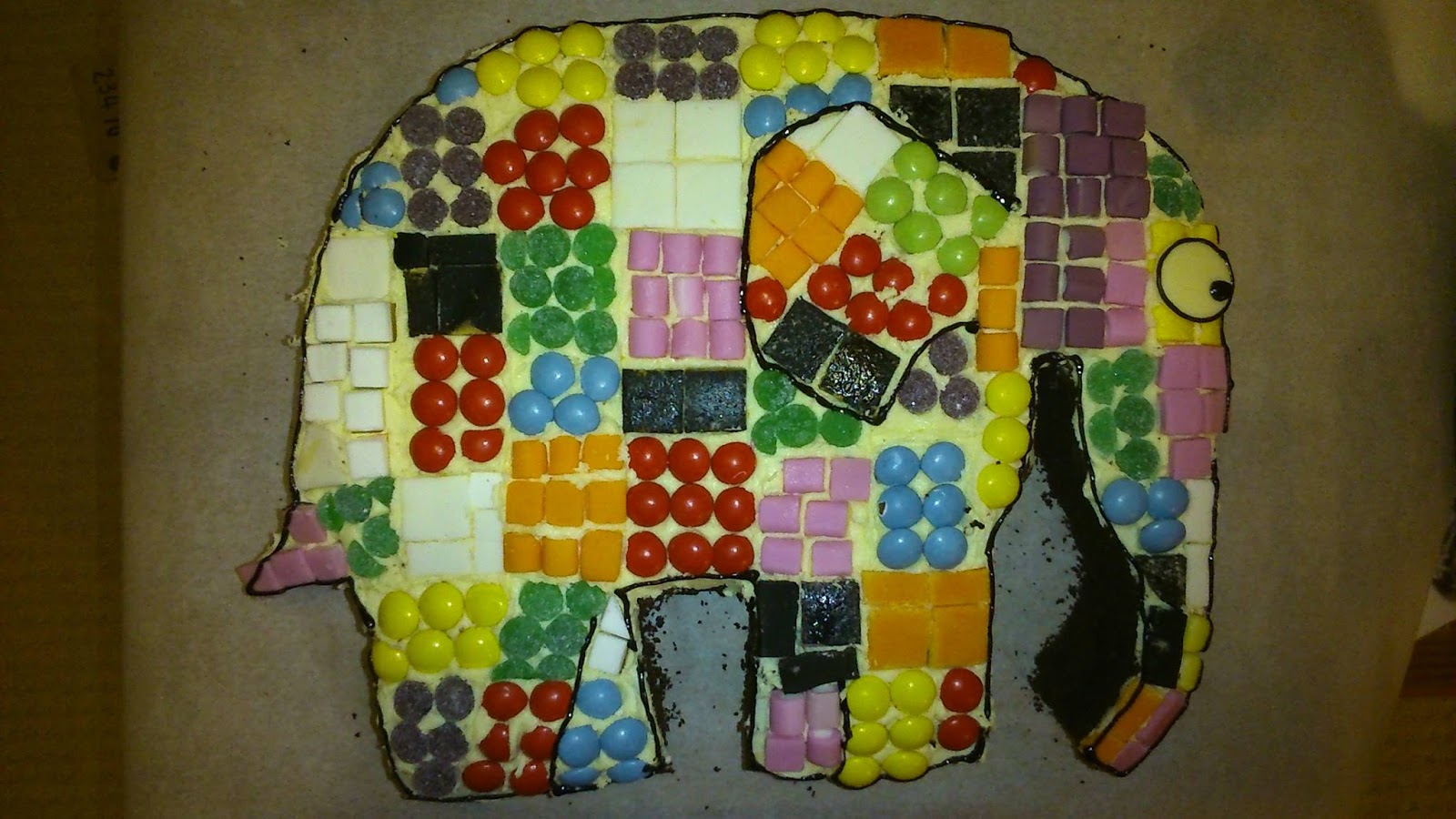
Finally, a couple of my favourites that are not geographical at all - enjoy!


Wednesday 20 February 2013

COASTAL PROCESSES: Case Study!


This cake was made in preparation for a Year 12 fieldtrip to Dorset, it also handily tied in with a student’s birthday on the first night of the residential.  In an attempt to crudely show variation in rock type and to use as a basis for the theoretical arguments over the formation of Lulworth Cove, I branched out and used a variety of cake types, so that not just the appearance but also the texture was representative of the changing geology.


Method
·         One portion of sponge mix had blue food colouring added for the sea (the usual blue butter icing was applied over the top)
·         One portion was hobnob-biscuit cake
·         One portion was carrot cake
·         One portion of the staple chocolate brownie
·         Butter icing for holding together the rock layers
·         Icing pens for the labels and LSD arrow
·         Desiccated coconut for white water/wave action

Application
For post-16, best used by placing the cake in the middle of a large piece of paper on the floor, giving each student a marker pen and getting them to label and annotate the cake as if it was a diagram. Following this, each student must answer a relevant exam question which must be peer assessed before anyone is allowed a slice!

Sunday 18 November 2012

COASTAL PROCESSES


This cake stemmed from a GCSE fieldwork adventure to the Dorset Coast. Thanks to the vision of my then HoD (and a bit of a long term planning/calendar nightmare) we took a group of our year 10 and 11 students to the coast for 3 days, before they had started the unit. We covered in 3 days what we might have arguably taken 6 weeks to teach in the classroom, and on our return the students took charge of the rest of the classes’ learning, based on their newly discovered knowledge and understanding.

In these first couple of years of teaching I have heard many arguments for and against the timing and objectives of fieldwork – to introduce, to consolidate, to bring to life, and in fact I have seen all of these done to good effect so I don’t really hold an opinion of whether one or other is “better”.  This particular trip was an example of quite literally teaching in the field. I thought it was great, the boys weren’t allowed to throw a stone into the sea until they had identified it or checked it for a fossil, and the girls could only take arty photos if they could label and annotate it on screen immediately afterwards. I enjoyed this very much, afterall, how easy is it in the classroom to understand that cliffs are millions of years old? Far better to see them right there in front of you and witness for yourself the evidence of their age, isn’t it? Anyway, I digress…where were we?

Method
This one involved branching out into a bit of geology… Experimenting with types of cake to represent types of rock. Hence I used not only the staple brownie recipe, but also a plain sponge recipe (I added a drop of milk to the usual recipe to make it slightly more gooey and pliable). 
·         One portion of sponge mix had blue food colouring added for the sea (the usual blue butter icing was applied over the top)
·         One portion had mixed peal added (to create a matrix rock)
·         One portion was layered in a loaf tin with the brownie to create the horizontal bedding seen on the coastline east of Bournemouth
·         Amaretto chocolate fingers (groynes)
·         Chocolate sprinkles (to show build-up of sediment on one side of groynes)
·         Crumbled layer-cake and pieces of crystallised ginger (landslip)

Application
Being aimed at GCSE students, this cake provides an ideal backdrop for practise exam questions. For example; Using the resource, describe and explain the processes affecting sediment movement on the coast (4) or Explain the management options available for coastal areas where erosion is taking place (6)

As before, it could be used at the centre of a discussion on what was learnt – in this case in the field. Students could use the cake to teach others about what they learnt, or as the basis for a particular case study. You could even branch out and ask “how might be measure the processes going on here?” if the cake is used prior to a fieldtrip. Maybe it could finally provide a fun way of involving students in the pre-trip risk assessment process?!

Tuesday 6 November 2012

TSUNAMI!


In a somewhat spooky turn of events, I made this cake just 4 days before the Japanese Tsunami 2011. It was all quite bizarre especially as many people commented that the land set up and overall design looked like the classic textbook diagram of Kobe. Needless to say I was then getting requests for “lottery winner” cakes from the Head of Department, but whatever, it was unexpectedly relevant.

Method
This was a plain-and-chocolate-brownie-marble-cake, and honestly, beyond thinking that the sea bed isn’t cocoa-coloured I can’t really remember my reasoning for moving away from the brownie base I had was comfortable with. You will see there are certain patterns beginning to be repeated, for example, the blue butter icing river and sea, and the green to represent agricultural/fertile land.

It’s not very clear on the photo but the sea in fact was spread on with a pallet knife and there is a pattern depicting the withdrawal of the sea prior to the tsunami waves hitting the shore. Other features:
·         A bit of desiccated coconut again, this time as waves crash
·         Glace cherry (epicentre)
·         Boot laces (S-Waves)
·         Liquorice Allsorts provided the closest I could get to buildings – and once squidged and broken slightly, showed signs of being damaged by an earthquake
·         Melted chocolate and brown icing (liquefaction)
·         Spare brownie, chocolate butter icing and crystallised ginger (high ground)
·         Butter icing so far seems to be the most reliable “glue” in this case for sticking the settlement to the main cake

Application
Nothing new here…see previous uses! Any other ideas? Perhaps could be used as an introduction to, rather than a summary of, the topic. What do students think are the main impacts? Do they understand the processes that cause this event? What Protection, Prevention and Prediction strategies could be used? Or have been used in Asia? 

Wednesday 31 October 2012

RIVER LONG PROFILE


On my main PGCE placement  I taught a very mixed year 10 group with whom I had a double lesson every week. I have mixed feelings about lessons that are two hours long, often being thankful for the amount I can get through with a GCSE group, whilst living in fear of how I will keep them engaged. It is a challenge to prevent them from becoming passive learners, especially in the latter stages of a lesson on, say, sediment transfer in river systems (I find it hard to grip 14 year olds on the issue of sediment size, especially once you throw the phrase “drop its load” into the equation). So, needless to say it was suggested by one of my flatmates that another cake could be just the ticket (I think she had ulterior motive given she had licked the bowls following the volcano adventures).


Method
Again this cake used the basic rectangular brownie, with just a little cut off the end this time – enough to provide triangles for a mountain range. For this model, you need to incorporate the landforms and processes that are relevant to the age group you want to use it with.
The one shown in the picture used the following:

·         Apricot jam brushed onto brownie mountains sprinkled over with desiccated coconut (snow)
·         Blue butter icing (river, sea)
·         Green and blue icing tubes (irrigation systems)
·         Crystallised ginger (beach/coastal material)
·         Chocolate sprinkles (carried sediment/debris from flood event)
The only real building here is the mountains (use same method as volcanoes) and digging out the river channel and sea (enough to spread icing on without raising sea level above land!) the rest is really decoration.

Application
Having been studying River Systems for a few weeks, the year 10s new their stuff pretty well, but were struggling to consolidate the long profile as we had taught it very much in chunks of cross profiles. So, to begin threading together these processes and landforms into one combined and active system we used the cake in the 10 minute “break” in the middle of the double lesson. It started off a bit more teacher led than the volcano plenary, with an explanation that helped them draw together the different sections of the river into a long profile.

Then it was their turn, and in a similar way to the volcano, a piece of cake was only received for a relevant contribution! Students could choose a piece of the cake to name/describe/explain and then got that piece of cake. They had their mid-lesson comfort break and ate cake happily until I dragged them back in for the second half…back to sediment size then…

This design has potential as a series of cross-sectional models too. The one I made did this to a degree but it was on a fairly mini scale. If you were to make this on a massive scale (quite how you would transport it to school I do not know, perhaps someone in Resistant Materials could custom make you a large board, hmm? In fact…) you could make your river channel deeper downstream, add in meanders and ox-bow lakes, make the outside of the bend deeper…the possibilities are quite endless. Of course there’s nothing to suggest it couldn’t be transformed into a Bangladesh case study cake, with three river channels, a delta, and mobile settlements affected by annual flooding events, and perhaps a rising sea level?